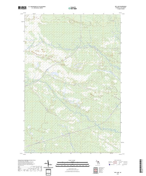
2023 Map of Roy Lake
USGS Topo · Published 2023About this map
The Tahquamenon River winds through the southern edge of this Luce County landscape, a region defined by extensive wetlands and a network of interior lakes. These waters, including Roy Lake, Quintus Lake, and Lynch Lake, are connected by a web of small drainages like Murphy Creek and Auger Creek. The terrain is navigated via specialized forest routes such as Hunters Truck Trl and the descriptively named Charcoal Grade Rd, which suggests the area's history of timber and resource management. This survey provides a contemporary view of the Upper Peninsula’s hydrology, tracing the paths of Sucker Creek and Gimlet Creek as they flow through the low-lying reaches of the eastern Tahquamenon watershed.
Find a feature on this map
20 named features on this map. Tap any name to fly to it.
Don’t see what you’re looking for? This feature index may not catch every label — zoom into the map to look around manually.
Map Details
Editions of this 2023 Roy Lake Map
This is the sole edition of this map. No revisions or reprints were ever made.
Other maps of this area

1954 · Sault Sainte Marie
USGS Topo · 1:250,000

1956 · Sault Sainte Marie
USGS Topo · 1:250,000

1957 · Sault Sainte Marie
USGS Topo · 1:250,000

1958 · Sault Sainte Marie
USGS Topo · 1:250,000

1962 · Auger Lake
USGS Topo · 1:24,000

1968 · Muskallonge Lake SE
USGS Topo · 1:24,000

1968 · Betsy Lake SW
USGS Topo · 1:24,000
1968 · Betsy Lake South
USGS Topo · 1:24,000
1973 · Newberry
USGS Topo · 1:24,000
1973 · Roberts Corner
USGS Topo · 1:24,000