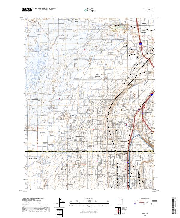
2023 Map of Roy
USGS Topo · Published 2023About this map
Hill Air Force Base dominates the southeastern corner of this contemporary survey, reflecting the continued military significance of this region within the northern Wasatch Front. The landscape is characterized by a dense suburban grid and a complex network of irrigation and water management, including the West Weber Canal and South Branch Wilson Canal. These waterways underscore the historical agricultural roots of communities like Roy, West Point, and Clinton, even as modern residential and commercial development has filled much of the available land.
Find a feature on this map
239 named features on this map. Tap any name to fly to it.
Don’t see what you’re looking for? This feature index may not catch every label — zoom into the map to look around manually.
Map Details
Editions of this 2023 Roy Map
This is the sole edition of this map. No revisions or reprints were ever made.
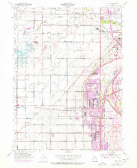
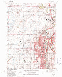
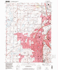
Historical Maps of Ogden Through Time
4 maps found