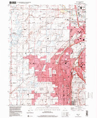
1999 Map of Roy
USGS Topo · Published 2001About this map
Hill Air Force Base dominates the southeastern quadrant of this Weber and Davis County landscape, illustrating the significant military and aviation footprint in the region at the end of the century. The area is defined by the rapid convergence of urban and industrial development between Roy, Sunset, and Clinton, set against the complex hydrology of the Weber River and its numerous irrigation channels like the Hooper Canal and Layton Canal.
Find a feature on this map
83 named features on this map. Tap any name to fly to it.
Don’t see what you’re looking for? This feature index may not catch every label — zoom into the map to look around manually.
Map Details
Editions of this 1999 Roy Map
This is the sole edition of this map. No revisions or reprints were ever made.
Other maps of this area

1954 · Antelope Island North
USGS Topo · 1:24,000

1954 · Ogden
USGS Topo · 1:250,000

1954 · Brigham City
USGS Topo · 1:250,000

1955 · Ogden
USGS Topo · 1:24,000

1955 · Plain City
USGS Topo · 1:24,000

1955 · Clearfield
USGS Topo · 1:24,000

1955 · Roy
USGS Topo · 1:24,000

1955 · Plain City SW
USGS Topo · 1:24,000

1955 · North Ogden
USGS Topo · 1:24,000

1955 · Kaysville
USGS Topo · 1:24,000