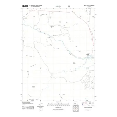
2011 Map of Royal Gorge
USGS Topo · Published 2011About this map
The Arkansas River carves a deep path through this landscape, most notably forming the Royal Gorge where the iconic Royal Gorge Bridge spans the chasm. This high-country region near Cañon City is defined by its deep mining and quarrying history, with numerous operations like the School Section Mine, Border Feldspar Mine, and Meyers Mine dotting the hills. The terrain is a complex network of canyons and peaks, including the Grand Canyon Hills and Gorge Hills, alongside landmarks such as YMCA Mountain and Fremont Peak. Irrigation infrastructure, including the Deweese Dye Ditch and South Canon Ditch, indicates the managed water use required for the surrounding area. To the west, the settlement of Parkdale sits near the junction of several gulches, while the theme-park location of Buckskin Joe provides a localized cultural point of interest amidst the wilderness of Temple Canyon.
Find a feature on this map
63 named features on this map. Tap any name to fly to it.
Don’t see what you’re looking for? This feature index may not catch every label — zoom into the map to look around manually.
Map Details
Editions of this 2011 Royal Gorge Map
This is the sole edition of this map. No revisions or reprints were ever made.
Other maps of this area

1889 · Canon City
USGS Topo · 1:125,000

1892 · Canon City
USGS Topo · 1:125,000

1894 · Pikes Peak
USGS Topo · 1:125,000

1901 · Pikes Peak
USGS Topo · 1:125,000

1942 · Cover Mtn.
USGS Topo · 1:62,500

1948 · Cover Mtn.
USGS Topo · 1:62,500

1954 · Cooper Mountain
USGS Topo · 1:24,000

1954 · Pueblo
USGS Topo · 1:250,000

1957 · Pueblo
USGS Topo · 1:250,000

1958 · Pueblo
USGS Topo · 1:250,000