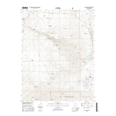
2016 Map of Royal Gorge
USGS Topo · Published 2016About this map
The Arkansas River carves a deep path through this landscape, centered on the architectural feat of the Royal Gorge Bridge. This high-altitude terrain is defined by dramatic elevation changes, from the heights of Fremont Peak and Dawson Mtn to the many gulches like Bumback Gulch and Hellgate Gulch that drain toward the river. To the north, the settlement of Buckskin Joe and the open expanses of Eightmile Park contrast with the rugged canyons below. Near the western edge of Cañon City, the map details the transition from residential developments to protected lands within the San Isabel National Forest. Local infrastructure is prominent, including the Arkansas Riverwalk and De Weese Dye Ditch, alongside recreational landmarks such as Cañon City Hot Springs and Wolf Park.
Find a feature on this map
76 named features on this map. Tap any name to fly to it.
Don’t see what you’re looking for? This feature index may not catch every label — zoom into the map to look around manually.
Map Details
Editions of this 2016 Royal Gorge Map
This is the sole edition of this map. No revisions or reprints were ever made.
Other maps of this area

1889 · Canon City
USGS Topo · 1:125,000

1892 · Canon City
USGS Topo · 1:125,000

1894 · Pikes Peak
USGS Topo · 1:125,000

1901 · Pikes Peak
USGS Topo · 1:125,000

1942 · Cover Mtn.
USGS Topo · 1:62,500

1948 · Cover Mtn.
USGS Topo · 1:62,500

1954 · Cooper Mountain
USGS Topo · 1:24,000

1954 · Pueblo
USGS Topo · 1:250,000

1957 · Pueblo
USGS Topo · 1:250,000

1958 · Pueblo
USGS Topo · 1:250,000