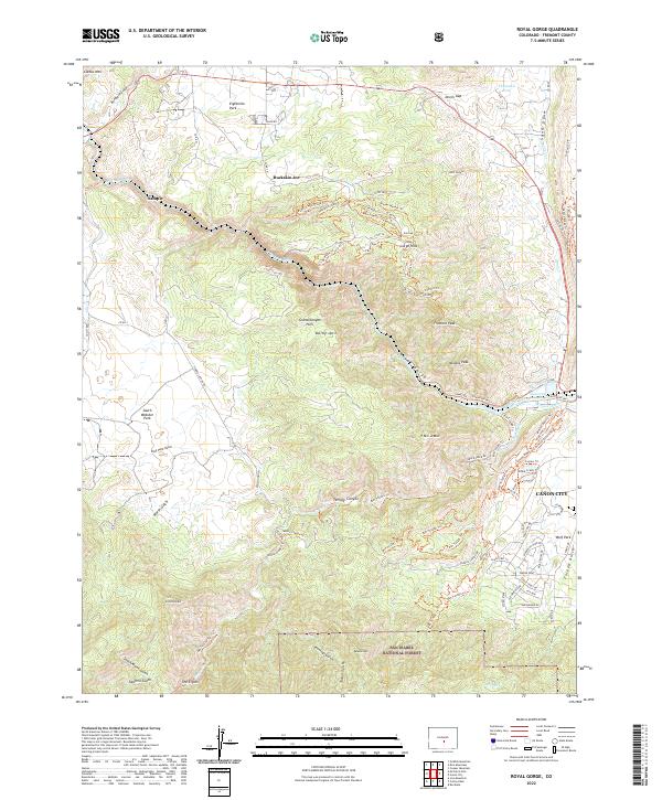
2022 Map of Royal Gorge
USGS Topo · Published 2022About this map
Royal Gorge dominates the landscape where the Arkansas River carves through the central Colorado plateau, creating a dramatic corridor of vertical relief. Along the river's path, the Hydraulic Ditch and Canon Ditch signify the long-standing water management systems essential to the development of the region. On the eastern edge of the survey, Cañon City serves as the primary urban anchor, while the legacy of the Old West remains visible at Buckskin Joe, a frontier-themed attraction and film set. The surrounding high ground is defined by prominent summits such as Fremont Peak and Y M C A Mtn, as well as the dense network of gulches like Marsh Gulch and Sawmill Gulch that drain toward the river. Much of the southern portion of the map is protected within the San Isabel National Forest, featuring the secluded Temple Canyon and a complex system of recreational trails such as the Dark Side Of The Moon Trl and Made In The Shade Trl.
Find a feature on this map
98 named features on this map. Tap any name to fly to it.
Don’t see what you’re looking for? This feature index may not catch every label — zoom into the map to look around manually.
Map Details
Editions of this 2022 Royal Gorge Map
This is the sole edition of this map. No revisions or reprints were ever made.
Other maps of this area

1889 · Canon City
USGS Topo · 1:125,000

1892 · Canon City
USGS Topo · 1:125,000

1894 · Pikes Peak
USGS Topo · 1:125,000

1901 · Pikes Peak
USGS Topo · 1:125,000

1942 · Cover Mtn.
USGS Topo · 1:62,500

1948 · Cover Mtn.
USGS Topo · 1:62,500

1954 · Cooper Mountain
USGS Topo · 1:24,000

1954 · Pueblo
USGS Topo · 1:250,000

1957 · Pueblo
USGS Topo · 1:250,000

1958 · Pueblo
USGS Topo · 1:250,000