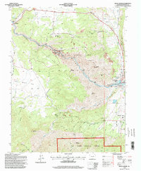
1994 Map of Royal Gorge
USGS Topo · Published 1998About this map
The deep canyon carved by the Arkansas River dominates this mid-1990s topographic survey of Fremont County. The terrain transitions from the open stretches of Eightmile Park in the north to the dramatic vertical relief of Grand Canyon of the Arkansas and the Royal Gorge. Just north of the river, the settlement of Buckskin Joe stands near the Railroad, while the community of Parkdale sits at the western edge of the quadrangle. Significant elevation markers like Baldy Mountain and Noname Peak overlook the river valley, while the southern portion of the map is defined by the steep drainages of Temple Canyon and Grape Creek.
Find a feature on this map
2 named features on this map. Tap any name to fly to it.
Don’t see what you’re looking for? This feature index may not catch every label — zoom into the map to look around manually.
Map Details
Editions of this 1994 Royal Gorge Map
This is the sole edition of this map. No revisions or reprints were ever made.
Other maps of this area

1889 · Canon City
USGS Topo · 1:125,000

1892 · Canon City
USGS Topo · 1:125,000

1894 · Pikes Peak
USGS Topo · 1:125,000

1901 · Pikes Peak
USGS Topo · 1:125,000

1942 · Cover Mtn.
USGS Topo · 1:62,500

1948 · Cover Mtn.
USGS Topo · 1:62,500

1954 · Cooper Mountain
USGS Topo · 1:24,000

1954 · Pueblo
USGS Topo · 1:250,000

1957 · Pueblo
USGS Topo · 1:250,000

1958 · Pueblo
USGS Topo · 1:250,000