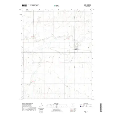
2018 Map of Rozel
USGS Topo · Published 2018About this map
Rozel serves as the primary hub of this Pawnee County landscape, centered at the intersection of W Edwards Ave and N Pawnee St. The settlement's layout is defined by its agricultural surroundings, with the Rozel Cem located just north of the town center near Saver Dr. This 2018 survey reveals a terrain shaped by the winding course of the Pawnee River, which snakes across the northern sections of the map, while the steady flow of Sawmill Cr cuts through the central and southern reaches. The grid of county roads, including 330 Ave and M Rd, illustrates the methodical division of the Kansas prairie into large agricultural tracts, a pattern that has persisted since the initial land surveys of the late nineteenth century.
Find a feature on this map
17 named features on this map. Tap any name to fly to it.
Don’t see what you’re looking for? This feature index may not catch every label — zoom into the map to look around manually.
Map Details
Editions of this 2018 Rozel Map
This is the sole edition of this map. No revisions or reprints were ever made.
Other maps of this area

1889 · Larned
USGS Topo · 1:125,000

1891 · Larned
USGS Topo · 1:125,000

1892 · Ness
USGS Topo · 1:125,000

1894 · Ness
USGS Topo · 1:125,000

1955 · Great Bend
USGS Topo · 1:250,000

1957 · Great Bend
USGS Topo · 1:250,000

1958 · Great Bend
USGS Topo · 1:250,000
1970 · Rozel
USGS Topo · 1:24,000
1970 · Sanford
USGS Topo · 1:24,000
1970 · Burdett
USGS Topo · 1:24,000