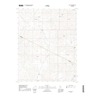
2018 Map of Ruby Canyon
USGS Topo · Published 2018About this map
The Diablo Range defines the topography of this corner of Merced and San Benito counties, where a complex network of canyons and ridges dictates the movement of water and travelers. The S Fork Los Banos Cr and its tributaries carve deep through the landscape, creating distinct geological features such as Ruby Canyon, Molina Canyon, and the expansive Piedra Azul Canyon. To the southeast, the high ground of Ortigalita Ridge overlooks the Las Aguilas Valley, a region where the land opens into broader flats like Dairy Flat.
Find a feature on this map
23 named features on this map. Tap any name to fly to it.
Don’t see what you’re looking for? This feature index may not catch every label — zoom into the map to look around manually.
Map Details
Editions of this 2018 Ruby Canyon Map
This is the sole edition of this map. No revisions or reprints were ever made.
Other maps of this area

1913 · Panoche
USGS Topo · 1:125,000

1919 · San Benito
USGS Topo · 1:62,500

1920 · Carrisalito Spring
USGS Topo · 1:31,680

1922 · Quien Sabe
USGS Topo · 1:62,500

1922 · Ortigalita
USGS Topo · 1:31,680

1931 · San Benito
USGS Topo · 1:62,500

1940 · Quien Sabe
USGS Topo · 1:62,500

1940 · San Benito
USGS Topo · 1:62,500

1943 · Ortigalita Peak
USGS Topo · 1:62,500

1944 · Panoche Valley
USGS Topo · 1:62,500