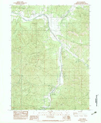
1983 Map of Ruch
USGS Topo · Published 1983About this map
Ruch sits at the northern end of this mountainous landscape, situated where the Applegate River valley begins to widen. This 1983 provisional survey documents a region defined by its steep peaks and numerous drainages, including Negro Ben Mtn and Tallowbox Mtn. The river serves as the primary corridor for human activity, hosting Cantrall-Buckley Park (Co) and several recreation sites.
Find a feature on this map
38 named features on this map. Tap any name to fly to it.
Don’t see what you’re looking for? This feature index may not catch every label — zoom into the map to look around manually.
Map Details
Editions of this 1983 Ruch Map
This is the sole edition of this map. No revisions or reprints were ever made.
Other maps of this area

1891 · Ashland
USGS Topo · 1:250,000

1893 · Ashland
USGS Topo · 1:250,000

1897 · Ashland
USGS Topo · 1:250,000

1908 · Grants Pass
USGS Topo · 1:125,000

1938 · Medford
USGS Topo · 1:125,000

1954 · Medford
USGS Topo · 1:62,500

1954 · Gold Hill
USGS Topo · 1:62,500

1954 · Talent
USGS Topo · 1:62,500

1954 · Ruch
USGS Topo · 1:62,500

1955 · Medford
USGS Topo · 1:250,000