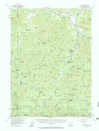
1954 Map of Ruch
USGS Topo · Published 1960About this map
The Applegate River and its tributary, the Little Applegate River, anchor this 1950s survey of Jackson and Josephine Counties. The landscape is defined by its mid-century mining legacy, evidenced by numerous extractive sites such as the Bone of Contention Mine and the Maid of the Mist Mine. Along the riverbanks, critical infrastructure like the McKee Bridge and a Footbridge near the settlement of Ruch facilitated local transport through the mountain passes.
Find a feature on this map
145 named features on this map. Tap any name to fly to it.
Don’t see what you’re looking for? This feature index may not catch every label — zoom into the map to look around manually.
Map Details
Editions of this 1954 Ruch Map
3 editions found

Other maps of this area

1886 · Shasta
USGS Topo · 1:250,000

1891 · Ashland
USGS Topo · 1:250,000

1893 · Ashland
USGS Topo · 1:250,000

1894 · Shasta
USGS Topo · 1:250,000

1897 · Ashland
USGS Topo · 1:250,000

1908 · Grants Pass
USGS Topo · 1:125,000

1914 · Seiad
USGS Topo · 1:125,000

1922 · Seiad
USGS Topo · 1:125,000

1932 · Yreka
USGS Topo · 1:96,000

1938 · Medford
USGS Topo · 1:125,000