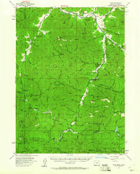
1954 Map of Ruch
USGS Topo · Published 1960About this map
Applegate River and its numerous tributaries dominate this mid-century survey of the Siskiyou Mountains along the Oregon-California border. The settlement of Ruch sits at the northern edge, serving as a gateway to a landscape defined by mining activity and forest management. Several prominent lode and placer operations are documented, including the Layton Mine and Maid of the Mist Mine, alongside the Steamboat Mine and the French Gl Mine to the south.
Find a feature on this map
146 named features on this map. Tap any name to fly to it.
Don’t see what you’re looking for? This feature index may not catch every label — zoom into the map to look around manually.
Map Details
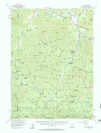
Editions of this 1954 Ruch Map
3 editions found

Other maps of this area

1886 · Shasta
USGS Topo · 1:250,000

1891 · Ashland
USGS Topo · 1:250,000

1893 · Ashland
USGS Topo · 1:250,000

1894 · Shasta
USGS Topo · 1:250,000

1897 · Ashland
USGS Topo · 1:250,000

1908 · Grants Pass
USGS Topo · 1:125,000

1914 · Seiad
USGS Topo · 1:125,000

1922 · Seiad
USGS Topo · 1:125,000

1932 · Yreka
USGS Topo · 1:96,000

1938 · Medford
USGS Topo · 1:125,000