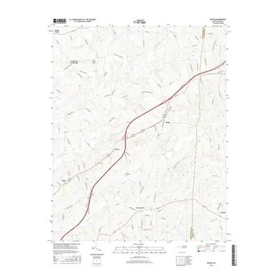
2016 Map of Ruffin
USGS Topo · Published 2016About this map
The community of Ruffin serves as a central hub on this map, situated where a local business route of the highway intersects with rural roads leading to Stacey and Lawsonville. The landscape is defined by the headwaters of Wolf Island Cr and Hogans Cr, which carve through the terrain of the Rockingham and Caswell County border. This area retains a distinctly agricultural character, with long-standing family names preserved in features like Stephens Crossroads and the Mullins-Stacy Cemetery.
Find a feature on this map
96 named features on this map. Tap any name to fly to it.
Don’t see what you’re looking for? This feature index may not catch every label — zoom into the map to look around manually.
Map Details
Editions of this 2016 Ruffin Map
This is the sole edition of this map. No revisions or reprints were ever made.
Other maps of this area

1923 · Danville
USGS Topo · 1:48,000

1924 · Draper
USGS Topo · 1:48,000

1925 · Danville
USGS Topo · 1:62,500

1926 · Draper
USGS Topo · 1:62,500

1944 · Draper
USGS Topo · 1:62,500

1953 · Greensboro
USGS Topo · 1:250,000

1954 · Greensboro
USGS Topo · 1:250,000

1962 · Greensboro
USGS Topo · 1:250,000

1965 · Danville
USGS Topo · 1:24,000
1965 · Brosville
USGS Topo · 1:24,000