2022 Map of Ruffin
USGS Topo · Published 2022About this map
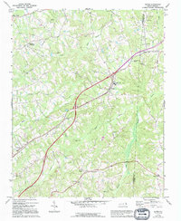
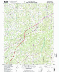
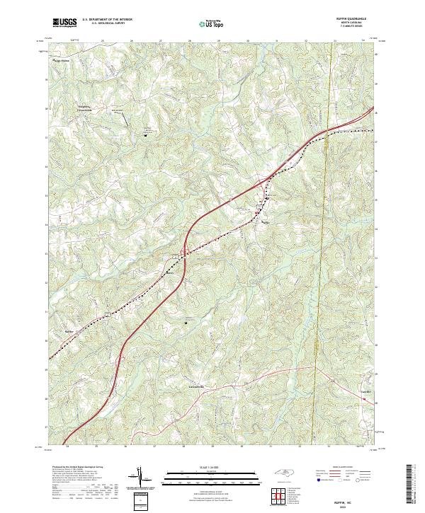
Ruffin serves as a central point of this North Carolina landscape, where the transport corridor of Old US Highway 29 and the modern expressway bisect the rural terrain of Rockingham County. The map documents a transition between early settlement patterns and contemporary infrastructure, with family heritage clearly preserved in the landscape through the Guerrant Martin Family Cem and Mullins Stacy Cem. Smaller communities like Lawsonville, Stephens Crossroads, and Stacey are connected by a network of local roads such as Mayfield Rd and Dickerson Rd. The drainage of the region is defined by the winding paths of Wolf Island Cr and Lick Fork, which carve through the undulating contours. To the northwest, the evocative name Happy Home sits near the headwaters of Birch Fork, while the BHH Aviation Airport adds a modern aviation footprint to the predominantly agricultural and wooded surroundings near the Caswell County line.
Find a feature on this map
95 named features on this map. Tap any name to fly to it.
Don’t see what you’re looking for? This feature index may not catch every label — zoom into the map to look around manually.
Map Details
Editions of this 2022 Ruffin Map
This is the sole edition of this map. No revisions or reprints were ever made.
Historical Maps of Oakhaven Farms Through Time
3 maps found