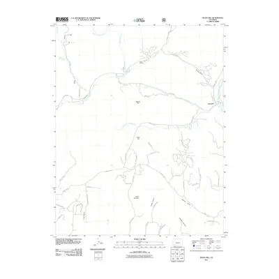
2011 Map of Rules Hill
USGS Topo · Published 2011About this map
Columbus and Vosburg Pike anchor this 2011 survey of the high-elevation terrain in La Plata County, defined by a complex drainage system between the Florida River and the Los Pinos River. The landscape is marked by prominent landforms such as Rules Hill and Rabbit Mountain, with numerous canyons and gulches like Homer Canyon and Spring Gulch carving the topography. Historically significant sites like the Shreck Cemetery are preserved on this record alongside more modern residential developments such as Elk Mdws. The map details a dense network of mountain roads, including Cherry Valley Rd and County Rd 228, which follow the natural contours of the canyons. The intersection of riparian corridors like North Fork Texas Creek and the surrounding peaks illustrates the transition between fertile valley bottoms and the upland territory characteristic of this part of Colorado.
Find a feature on this map
57 named features on this map. Tap any name to fly to it.
Don’t see what you’re looking for? This feature index may not catch every label — zoom into the map to look around manually.
Map Details
Editions of this 2011 Rules Hill Map
This is the sole edition of this map. No revisions or reprints were ever made.
Other maps of this area

1898 · Durango
USGS Topo · 1:62,500

1907 · Durango
USGS Topo · 1:62,500

1908 · Ignacio
USGS Topo · 1:125,000

1908 · Durango
USGS Topo · 1:62,500

1924 · Ignacio
USGS Topo · 1:125,000

1945 · Durango
USGS Topo · 1:250,000

1953 · Durango
USGS Topo · 1:250,000

1954 · Durango
USGS Topo · 1:250,000

1961 · Durango
USGS Topo · 1:250,000

1963 · Durango
USGS Topo · 1:250,000