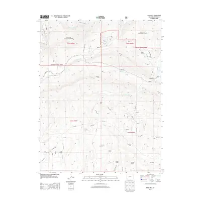
2013 Map of Rules Hill
USGS Topo · Published 2013About this map
San Juan National Forest defines the northern reaches of this landscape, where the Florida River and various forks of Texas Creek carve through the high terrain. The 2013 survey shows a transition from the forest's timbered slopes to the more open country near Long Hollow and the settlement of Columbus. Ranching and irrigation history is evident in features like Womer Ditch and the scattering of remote residences reached by roads such as Co RD 501.
Find a feature on this map
81 named features on this map. Tap any name to fly to it.
Don’t see what you’re looking for? This feature index may not catch every label — zoom into the map to look around manually.
Map Details
Editions of this 2013 Rules Hill Map
This is the sole edition of this map. No revisions or reprints were ever made.
Other maps of this area

1898 · Durango
USGS Topo · 1:62,500

1907 · Durango
USGS Topo · 1:62,500

1908 · Ignacio
USGS Topo · 1:125,000

1908 · Durango
USGS Topo · 1:62,500

1924 · Ignacio
USGS Topo · 1:125,000

1945 · Durango
USGS Topo · 1:250,000

1953 · Durango
USGS Topo · 1:250,000

1954 · Durango
USGS Topo · 1:250,000

1961 · Durango
USGS Topo · 1:250,000

1963 · Durango
USGS Topo · 1:250,000