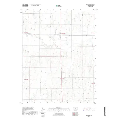
2018 Map of Rush Center
USGS Topo · Published 2018About this map
Rush Center serves as the focal point of this Central Kansas landscape, situated where the high plains meet the valley of Walnut Cr. The town's grid is detailed with specific local thoroughfares like W Union St and Florence St, while the surrounding rural landscape is systematically partitioned by a network of sectional roads including Ave O and CR 220. This 2018 survey illustrates the persistent agricultural and cemetery planning of the region, notably seen at Locust Hill Cem north of the town center. To the south, the topography is defined by the winding course of Otter Cr, highlighting the drainage patterns that have historically dictated land use and settlement in Rush County.
Find a feature on this map
34 named features on this map. Tap any name to fly to it.
Don’t see what you’re looking for? This feature index may not catch every label — zoom into the map to look around manually.
Map Details
Editions of this 2018 Rush Center Map
This is the sole edition of this map. No revisions or reprints were ever made.
Other maps of this area

1889 · Larned
USGS Topo · 1:125,000

1891 · Larned
USGS Topo · 1:125,000

1896 · Hays
USGS Topo · 1:125,000

1955 · Great Bend
USGS Topo · 1:250,000

1957 · Great Bend
USGS Topo · 1:250,000

1958 · Great Bend
USGS Topo · 1:250,000

1966 · Rush Center
USGS Topo · 1:24,000

1966 · Nekoma
USGS Topo · 1:24,000

1966 · La Crosse
USGS Topo · 1:24,000

1966 · Hargrave
USGS Topo · 1:24,000