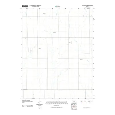
2009 Map of Rush Center SW
USGS Topo · Published 2009About this map
Oil extraction and agricultural grid lines define this rural Kansas landscape at the end of the first decade of the 2000s. The terrain is marked by multiple petroleum production zones, including the clustered Shiley Oil Field and Shiley East Oil Field in the west, and the Oro Oil Field complex to the east. These industrial sites are integrated into a sparse network of section roads, anchored by Correction Line Rd in the south. Drainage for this high plains area is provided by a series of north-flowing watercourses, most notably Old Maids Fork, Sandy Creek, and Cocklebur Creek. The map illustrates the persistent intersection of natural drainage patterns with the rigid human imposition of the Public Land Survey System, where modern energy infrastructure follows the same geometric logic as the nineteenth-century land parcels.
Find a feature on this map
11 named features on this map. Tap any name to fly to it.
Don’t see what you’re looking for? This feature index may not catch every label — zoom into the map to look around manually.
Map Details
Editions of this 2009 Rush Center SW Map
This is the sole edition of this map. No revisions or reprints were ever made.
Other maps of this area

1889 · Larned
USGS Topo · 1:125,000

1891 · Larned
USGS Topo · 1:125,000

1892 · Ness
USGS Topo · 1:125,000

1894 · Ness
USGS Topo · 1:125,000

1955 · Great Bend
USGS Topo · 1:250,000

1957 · Great Bend
USGS Topo · 1:250,000

1958 · Great Bend
USGS Topo · 1:250,000

1966 · Alexander
USGS Topo · 1:24,000

1966 · Rush Center
USGS Topo · 1:24,000

1966 · Nekoma
USGS Topo · 1:24,000