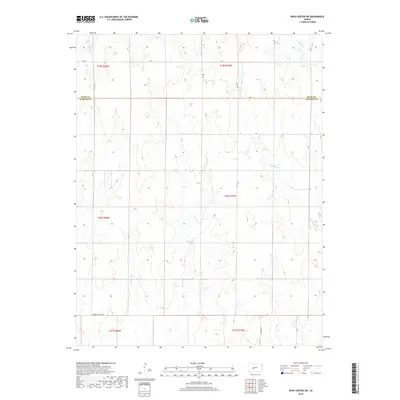
2018 Map of Rush Center SW
USGS Topo · Published 2018About this map
The high plains of western Kansas are defined here by a series of north-flowing intermittent drainage systems that cut through the agricultural landscape. Cocklebur Cr dominates the eastern half of the quadrangle, joined by Sandy Cr and Otter Cr as they move toward the Walnut Creek basin. This 2018 survey reveals a strictly organized section-line road network, including notable thoroughfares such as Ave X and Cr 180. The southern edge is anchored by the Correction Line Rd, a significant surveying landmark that accounts for the earth's curvature in the original Public Land Survey System. Located along the boundary of Rush and Pawnee Counties, the area reflects a deeply rooted ranching and farming tradition where the terrain is dictated by these subtle creek valleys rather than major settlements. Traceable local routes like N Pawnee St and Y Rd provide access to the dispersed farmsteads characteristic of the region.
Find a feature on this map
19 named features on this map. Tap any name to fly to it.
Don’t see what you’re looking for? This feature index may not catch every label — zoom into the map to look around manually.
Map Details
Editions of this 2018 Rush Center SW Map
This is the sole edition of this map. No revisions or reprints were ever made.
Other maps of this area

1889 · Larned
USGS Topo · 1:125,000

1891 · Larned
USGS Topo · 1:125,000

1892 · Ness
USGS Topo · 1:125,000

1894 · Ness
USGS Topo · 1:125,000

1955 · Great Bend
USGS Topo · 1:250,000

1957 · Great Bend
USGS Topo · 1:250,000

1958 · Great Bend
USGS Topo · 1:250,000

1966 · Alexander
USGS Topo · 1:24,000

1966 · Rush Center
USGS Topo · 1:24,000

1966 · Nekoma
USGS Topo · 1:24,000