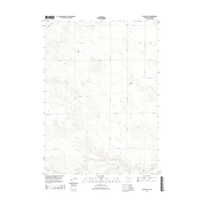
2014 Map of Rushville NE
USGS Topo · Published 2014About this map
Niobrara River flows through the southern reaches of this Sheridan County landscape, where the high plains of northern Nebraska meet complex drainage systems. The terrain is defined by dramatic elevation changes, notably around Lone Butte and the winding course of Rush Cr. A strictly organized grid of rural roads, including 610th Rd and 250th Ln, provides access across the open country, while Us-20 clips the northwestern corner of the quadrangle. Significant erosional features like Sand Draw demonstrate the local geological character, illustrating how water has shaped the sandy soils of this region over time. This 2014 survey documents the persistence of a sparsely populated ranching and agricultural landscape in the decade following the turn of the millennium.
Find a feature on this map
17 named features on this map. Tap any name to fly to it.
Don’t see what you’re looking for? This feature index may not catch every label — zoom into the map to look around manually.
Map Details
Editions of this 2014 Rushville NE Map
This is the sole edition of this map. No revisions or reprints were ever made.
Other maps of this area

1955 · Alliance
USGS Topo · 1:250,000

1957 · Alliance
USGS Topo · 1:250,000

1958 · Alliance
USGS Topo · 1:250,000
1966 · Rushville
USGS Topo · 1:24,000
1966 · Rushville SW
USGS Topo · 1:24,000
1969 · Rushville 4 SW
USGS Topo · 1:24,000
1969 · Gordon
USGS Topo · 1:24,000
1969 · Clinton
USGS Topo · 1:24,000
1969 · Clinton SW
USGS Topo · 1:24,000
1969 · Rushville SE
USGS Topo · 1:24,000