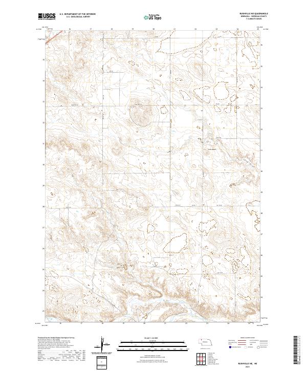
2021 Map of Rushville NE
USGS Topo · Published 2021About this map
Lone Butte stands as a prominent topographical anchor in this section of Sheridan County, where the landscape is defined by the drainage patterns of Rush Cr and Sand Draw. The 2021 survey reveals a disciplined grid of rural section-line roads, such as Cemetery Rd and 580th Rd, which carve the prairie into traditional agricultural blocks. This region, documented within townships T31N and T32N, illustrates the persistent layout of the High Plains, where water sources like Rush Cr dictate the orientation of land use. The presence of Cemetery Rd suggests a proximity to localized family or community history centers, even in a sparsely populated environment. Researchers can observe the subtle elevation changes that distinguish the butte from the surrounding drainages, providing a clear picture of the Nebraska panhandle's geography in the early 21st century.
Find a feature on this map
24 named features on this map. Tap any name to fly to it.
Don’t see what you’re looking for? This feature index may not catch every label — zoom into the map to look around manually.
Map Details
Editions of this 2021 Rushville NE Map
This is the sole edition of this map. No revisions or reprints were ever made.
Other maps of this area

1955 · Alliance
USGS Topo · 1:250,000

1957 · Alliance
USGS Topo · 1:250,000

1958 · Alliance
USGS Topo · 1:250,000

1966 · Rushville
USGS Topo · 1:24,000

1966 · Rushville SW
USGS Topo · 1:24,000

1969 · Rushville 4 SW
USGS Topo · 1:24,000

1969 · Gordon
USGS Topo · 1:24,000

1969 · Clinton
USGS Topo · 1:24,000

1969 · Clinton SW
USGS Topo · 1:24,000

1969 · Rushville SE
USGS Topo · 1:24,000