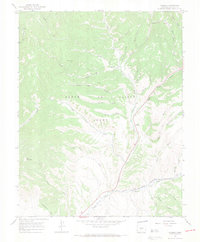
1967 Map of Russell
USGS Topo · Published 1971About this map
The Sangre de Cristo Grant defines the southern Colorado high country depicted here, where a network of gulches and canyons descend from the peaks into the valley. The settlement of Russell sits as a primary point of reference along the Sangre de Cristo Creek, serving the local ranching and mining interests of the era. Evidence of early mineral exploration is visible through several Prospects and a Prospect scattered across the northern slopes, particularly near Buckskin Gulch and Grayback Gulch.
Find a feature on this map
37 named features on this map. Tap any name to fly to it.
Don’t see what you’re looking for? This feature index may not catch every label — zoom into the map to look around manually.
Map Details
Editions of this 1967 Russell Map
3 editions found
Other maps of this area

1889 · Huerfano Park
USGS Topo · 1:125,000

1892 · Huerfano Park
USGS Topo · 1:125,000

1954 · Trinidad
USGS Topo · 1:250,000

1955 · Trinidad
USGS Topo · 1:250,000

1958 · Trinidad
USGS Topo · 1:250,000

1959 · Trinidad
USGS Topo · 1:250,000

1963 · Mc Carty Park
USGS Topo · 1:24,000

1963 · La Veta Pass
USGS Topo · 1:24,000

1967 · Mosca Pass
USGS Topo · 1:24,000
1967 · Blanca Peak
USGS Topo · 1:24,000