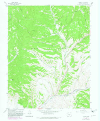
1967 Map of Russell
USGS Topo · Published 1982About this map
The Sangre De Cristo Grant dominates this 1967 landscape in Costilla County, illustrating the intersection of large-scale land grants and the rugged alpine terrain of southern Colorado. The small settlement of Russell serves as a focal point along the narrow valley of Sangre de Cristo Creek, where the Denver and Rio Grande Western railroad corridor winds through the mountainous passes. The geography is defined by a dense network of watercourses and canyons, including Malo Vega Creek and Bronco Dan Gulch, which feed into the larger creek systems.
Find a feature on this map
42 named features on this map. Tap any name to fly to it.
Don’t see what you’re looking for? This feature index may not catch every label — zoom into the map to look around manually.
Map Details
Editions of this 1967 Russell Map
3 editions found
Other maps of this area

1889 · Huerfano Park
USGS Topo · 1:125,000

1892 · Huerfano Park
USGS Topo · 1:125,000

1954 · Trinidad
USGS Topo · 1:250,000

1955 · Trinidad
USGS Topo · 1:250,000

1958 · Trinidad
USGS Topo · 1:250,000

1959 · Trinidad
USGS Topo · 1:250,000

1963 · Mc Carty Park
USGS Topo · 1:24,000

1963 · La Veta Pass
USGS Topo · 1:24,000

1967 · Mosca Pass
USGS Topo · 1:24,000
1967 · Blanca Peak
USGS Topo · 1:24,000