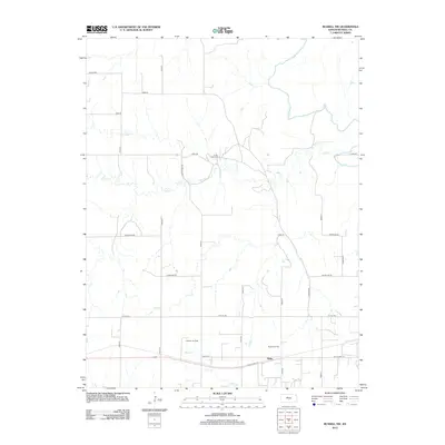
2012 Map of Russell NW
USGS Topo · Published 2012About this map
Balta sits along the southern edge of this West-Central Kansas landscape, situated near the path of Old US Hwy 40. This region in Russell County is defined by the extensive petroleum industry, with large extraction areas such as the Gorham Oil Field, Russell Oil Field, and the S and S Oil Field spanning the rural sections between the hills. The drainage patterns of the Saline River and its tributaries, including Salt Cr and Fossil Cr, dictate the local topography and road placement. A grid of county roads, such as Reservoir Rd and Shoreline Rd, provides access to these oil-producing areas and the creek valleys, reflecting the region's dual reliance on natural resource extraction and rural transport networks.
Find a feature on this map
26 named features on this map. Tap any name to fly to it.
Don’t see what you’re looking for? This feature index may not catch every label — zoom into the map to look around manually.
Map Details
Editions of this 2012 Russell NW Map
This is the sole edition of this map. No revisions or reprints were ever made.
Other maps of this area

1896 · Osborne
USGS Topo · 1:125,000

1896 · Russell
USGS Topo · 1:125,000

1896 · Hays
USGS Topo · 1:125,000

1896 · Plainville
USGS Topo · 1:125,000

1955 · Great Bend
USGS Topo · 1:250,000

1955 · Beloit
USGS Topo · 1:250,000

1957 · Great Bend
USGS Topo · 1:250,000

1958 · Great Bend
USGS Topo · 1:250,000

1959 · Beloit
USGS Topo · 1:250,000
1961 · Walker
USGS Topo · 1:24,000