
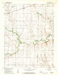
1967 Map of Russell NW
USGS Topo · Published 1968About this map
The Saline River winds through the northern portion of this central Kansas landscape, while the southern reaches are defined by a heavy industrial footprint. The expansive Paradise Oil Field, Russell Oil Field, and Gorham Oil Field dominate the terrain, marked by a dense concentration of oil wells and drill holes that speak to the region's mid-century petroleum economy. Along the southern border, the Union Pacific railroad tracks run parallel to the small settlement of Balta, providing a critical transit link for the area's resources.
Find a feature on this map
15 named features on this map. Tap any name to fly to it.
Don’t see what you’re looking for? This feature index may not catch every label — zoom into the map to look around manually.
Map Details
Editions of this 1967 Russell NW Map
This is the sole edition of this map. No revisions or reprints were ever made.
Other maps of this area

1896 · Osborne
USGS Topo · 1:125,000

1896 · Russell
USGS Topo · 1:125,000

1896 · Hays
USGS Topo · 1:125,000

1896 · Plainville
USGS Topo · 1:125,000

1955 · Great Bend
USGS Topo · 1:250,000

1955 · Beloit
USGS Topo · 1:250,000

1957 · Great Bend
USGS Topo · 1:250,000

1958 · Great Bend
USGS Topo · 1:250,000

1959 · Beloit
USGS Topo · 1:250,000
1961 · Walker
USGS Topo · 1:24,000