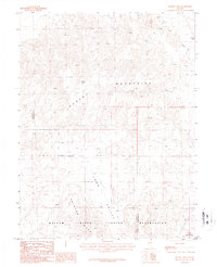
1987 Map of Russell Spit
USGS Topo · Published 1987About this map
The Walker River Indian Reservation occupies the southern portion of this high-desert landscape, defined by its stark geological formations and extractive history. In the late 1980s, the terrain was characterized by the high elevations of the Desert Mountains, where Desert Peak and the curious Russell Spit rise above the surrounding basin. To the south, the flat-topped Painted Mesa overlooks Long Valley, providing a clear view of the natural drainage patterns in this arid environment. Evidence of human industry is concentrated in the northeast, where Open Pit Mines, a Prospect, and an Adit indicate a history of mineral exploration. The map also records specialized wildlife features, such as the Guzzler water sources placed across the slopes of the Terrill Mountains.
Find a feature on this map
16 named features on this map. Tap any name to fly to it.
Don’t see what you’re looking for? This feature index may not catch every label — zoom into the map to look around manually.
Map Details
Editions of this 1987 Russell Spit Map
This is the sole edition of this map. No revisions or reprints were ever made.
Other maps of this area

1908 · Carson Sink
USGS Topo · 1:250,000

1910 · Carson Sink
USGS Topo · 1:250,000

1951 · Carson Lake
USGS Topo · 1:62,500

1951 · Allen Springs
USGS Topo · 1:62,500

1951 · Weber Reservoir
USGS Topo · 1:62,500

1951 · Fallon
USGS Topo · 1:62,500

1957 · Reno
USGS Topo · 1:250,000

1959 · Reno
USGS Topo · 1:250,000

1960 · Reno
USGS Topo · 1:250,000

1979 · Fallon
USGS Topo · 1:100,000