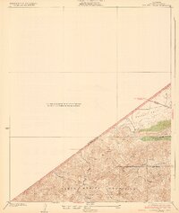
1932 Map of Russell Valley
USGS Topo · Published 1932About this map
The Santa Monica Mountains dominate the southern portion of this 1932 topographic sheet, where sharp elevation gains define the approach to the Las Virgenes area. This survey, conducted just before major residential expansion, captures the early automotive route of the Ventura Highway as it cuts across the northern landscape near Russell Valley. The topography is marked by a network of steep drainages, including Triunfo Canyon and Lobo Canyon, which underscore the geographic isolation of these coastal ranges during the early twentieth century.
Find a feature on this map
13 named features on this map. Tap any name to fly to it.
Don’t see what you’re looking for? This feature index may not catch every label — zoom into the map to look around manually.
Map Details
Editions of this 1932 Russell Valley Map
2 editions found
Other maps of this area

1900 · Triunfo Pass
USGS Topo · 1:62,500

1903 · Camulos
USGS Topo · 1:125,000

1921 · Triunfo Pass
USGS Topo · 1:62,500

1929 · Dume Point
USGS Topo · 1:24,000

1929 · Vejor
USGS Topo · 1:24,000

1929 · Solstice Canyon
USGS Topo · 1:24,000

1932 · Dume Point
USGS Topo · 1:24,000

1932 · Seminole
USGS Topo · 1:24,000

1932 · Russell Valley
USGS Topo · 1:24,000

1932 · Arroyo Sequit
USGS Topo · 1:24,000
Featured Places
- Thousand Oaks, CA
- Agoura Hills, CA
- Westlake Village, CA
- Rolling Oaks Ranch, CA
- Triunfo Corner, Thousand Oaks