
1932 Map of Russell Valley
USGS Topo · Published 1932About this map
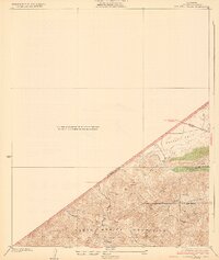
Santa Monica Mountains peaks and steep-walled drainages dominate this portion of the western range near the Ventura and Los Angeles County line. The 1929 topography recorded by C.W.H.Nessler reveals a landscape defined by rugged canyons such as Triunfo Canyon and Lobo Canyon that cut through the land grants of El Conejo and Las Virgenes. Transportation is centered on the early route of the U.S. Ventura Highway No 101 and the winding Decker Road, reflecting the transition from agricultural ranch lands to a more accessible regional corridor.
Find a feature on this map
13 named features on this map. Tap any name to fly to it.
Don’t see what you’re looking for? This feature index may not catch every label — zoom into the map to look around manually.
Map Details
Editions of this 1932 Russell Valley Map
2 editions found
Other maps of this area

1900 · Triunfo Pass
USGS Topo · 1:62,500

1903 · Camulos
USGS Topo · 1:125,000

1921 · Triunfo Pass
USGS Topo · 1:62,500

1929 · Dume Point
USGS Topo · 1:24,000

1929 · Vejor
USGS Topo · 1:24,000

1929 · Solstice Canyon
USGS Topo · 1:24,000

1932 · Dume Point
USGS Topo · 1:24,000

1932 · Seminole
USGS Topo · 1:24,000

1932 · Arroyo Sequit
USGS Topo · 1:24,000
1932 · Solstice Canyon
USGS Topo · 1:24,000
Featured Places
- Thousand Oaks, CA
- Agoura Hills, CA
- Westlake Village, CA
- Rolling Oaks Ranch, CA
- Triunfo Corner, Thousand Oaks