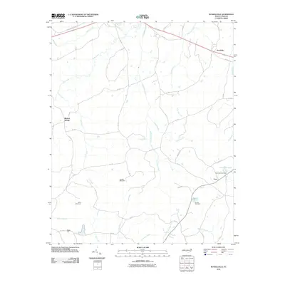
2010 Map of Russellville
USGS Topo · Published 2010About this map
The crossroads of Russellville and the small cluster at Mineral Springs define the rural character of this Anson County landscape. Numerous watercourses, including Brown Creek and Pinch Gut Creek, carve through the terrain, punctuated by local landmarks like Gordon Mountain and Becky Hill. The distribution of farm-to-market roads, such as Peachland-Polkton Rd and Horton Rd, suggests a long-established agricultural community where family-named features like Frank Little Pond and Gaddys Pond remain central to the local geography. Small settlements like Travis and the White Store Dam further indicate the localized nature of industry and resource management in this region of North Carolina. The map provides a clear view of the drainage patterns feeding into the South Fork Jones Creek and Middle Fork Jones Creek, reflecting the importance of these small tributaries to the surrounding land.
Find a feature on this map
50 named features on this map. Tap any name to fly to it.
Don’t see what you’re looking for? This feature index may not catch every label — zoom into the map to look around manually.
Map Details
Editions of this 2010 Russellville Map
This is the sole edition of this map. No revisions or reprints were ever made.
Other maps of this area

1941 · Spartanburg
USGS Topo · 1:250,000

1953 · Spartanburg
USGS Topo · 1:250,000

1953 · Charlotte
USGS Topo · 1:250,000

1954 · Charlotte
USGS Topo · 1:250,000

1956 · Ansonville
USGS Topo · 1:24,000

1956 · Wadesboro
USGS Topo · 1:24,000

1960 · Charlotte
USGS Topo · 1:250,000

1960 · Spartanburg
USGS Topo · 1:250,000

1962 · Charlotte
USGS Topo · 1:250,000

1963 · Spartanburg
USGS Topo · 1:250,000