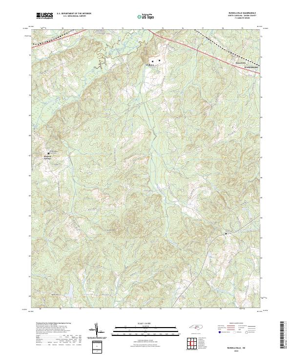
2022 Map of Russellville
USGS Topo · Published 2022About this map
Polkton and the western outskirts of Wadesboro anchor this survey of the North Carolina Piedmont. The landscape is defined by the drainage networks of Brown Creek and South Fork Jones Creek, where small ponds like Gaddys Pond and Frank Little Pond dot the agricultural and wooded terrain. Significant local institutions include the South Piedmont Community College L.L. Polk Campus and several community landmarks with deep genealogical roots, such as the Mineral Springs Baptist Church-Cem and Camden Church Cem. Rising above the surrounding creek beds, Gordon Mountain and Becky Hill provide the most prominent elevation in this part of Anson County. The map details an intricate network of local roads including Prison Camp Road and Poplar Hill Church Road, tracing the contemporary rural settlement patterns and local transit corridors.
Find a feature on this map
70 named features on this map. Tap any name to fly to it.
Don’t see what you’re looking for? This feature index may not catch every label — zoom into the map to look around manually.
Map Details
Editions of this 2022 Russellville Map
This is the sole edition of this map. No revisions or reprints were ever made.
Other maps of this area

1941 · Spartanburg
USGS Topo · 1:250,000

1953 · Spartanburg
USGS Topo · 1:250,000

1953 · Charlotte
USGS Topo · 1:250,000

1954 · Charlotte
USGS Topo · 1:250,000

1956 · Ansonville
USGS Topo · 1:24,000

1956 · Wadesboro
USGS Topo · 1:24,000

1960 · Charlotte
USGS Topo · 1:250,000

1960 · Spartanburg
USGS Topo · 1:250,000

1962 · Charlotte
USGS Topo · 1:250,000

1963 · Spartanburg
USGS Topo · 1:250,000