
1956 Map of Russellville
USGS Topo · Published 1956About this map
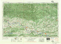
The Arkansas River carves a central valley through this mid-century landscape, separating the high peaks of the Boston Mountains to the north from the ridges of the Ouachita Mountains to the south. This 1956 survey records the region just as major hydrological changes were taking shape, showing the Greers Ferry Reservoir and Lake Dardanelle alongside established works like Nimrod Lake and Blue Mountain Lake. The infrastructure of the river-and-rail economy is evident, with the Missouri Pacific Railroad and Chicago, Rock Island and Pacific Railroad providing vital transport links between the river towns and the interior.
Find a feature on this map
178 named features on this map. Tap any name to fly to it.
Don’t see what you’re looking for? This feature index may not catch every label — zoom into the map to look around manually.
Map Details
Editions of this 1956 Russellville Map
2 editions found
Other maps of this area

1879 · Poteau Mountain
USGS Topo · 1:62,500

1879 · Cravens
USGS Topo · 1:62,500

1879 · Mountain Home
USGS Topo · 1:62,500

1879 · Washington
USGS Topo · 1:62,500

1887 · Poteau Mountain #1
USGS Topo · 1:62,500

1887 · Magazine Mountain #1
USGS Topo · 1:62,500

1887 · Smyrna
USGS Topo · 1:62,500

1887 · Magazine Mountain #4
USGS Topo · 1:62,500

1887 · Mount Ida #2
USGS Topo · 1:62,500

1887 · Magazine Mountain #2
USGS Topo · 1:62,500