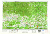
1964 Map of Russellville
USGS Topo · Published 1964About this map
The Arkansas River corridor serves as the primary artery for settlement and commerce across this mid-century landscape, threading between the Boston Mountains to the north and the Ouachita Mountains to the south. Towns like Russellville, Morrilton, and Clarksville are shown during a period of established growth, connected by the Missouri Pacific Railroad and U. S. Highway 64. The map captures the significant elevation changes of the region, from the heights of Magazine Mountain to the localized peaks of Mount Nebo and Petit Jean Mountain.
Find a feature on this map
188 named features on this map. Tap any name to fly to it.
Don’t see what you’re looking for? This feature index may not catch every label — zoom into the map to look around manually.
Map Details
Editions of this 1964 Russellville Map
This is the sole edition of this map. No revisions or reprints were ever made.
Other maps of this area
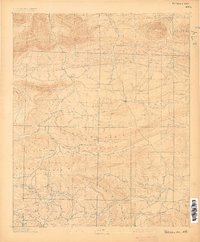
1879 · Poteau Mountain
USGS Topo · 1:62,500
1879 · Cravens
USGS Topo · 1:62,500
1879 · Mountain Home
USGS Topo · 1:62,500
1879 · Washington
USGS Topo · 1:62,500
1887 · Poteau Mountain #1
USGS Topo · 1:62,500
1887 · Magazine Mountain #1
USGS Topo · 1:62,500
1887 · Smyrna
USGS Topo · 1:62,500
1887 · Magazine Mountain #4
USGS Topo · 1:62,500
1887 · Mount Ida #2
USGS Topo · 1:62,500
1887 · Magazine Mountain #2
USGS Topo · 1:62,500