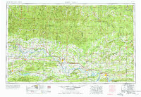
1977 Map of Russellville
USGS Topo · Published 1977About this map
Arkansas River Valley corridor serves as the central artery for this mid-century look at West-Central Arkansas, where the Arkansas River winds between the southern edge of the Boston Mountains and the northern reaches of the Ouachita Mountains. High points like Magazine Mountain and Mount Nebo overlook a landscape transitioning from the river-bottom agriculture of the Petit Jean River to the timber-rich hills of the Ozark National Forest. The map captures the significant educational and civic growth of the region, featuring Arkansas Tech University in Russellville and both Hendrix College and the University of Central Arkansas in Conway.
Find a feature on this map
218 named features on this map. Tap any name to fly to it.
Don’t see what you’re looking for? This feature index may not catch every label — zoom into the map to look around manually.
Map Details
Editions of this 1977 Russellville Map
This is the sole edition of this map. No revisions or reprints were ever made.
Other maps of this area

1879 · Poteau Mountain
USGS Topo · 1:62,500

1879 · Cravens
USGS Topo · 1:62,500

1879 · Mountain Home
USGS Topo · 1:62,500

1879 · Washington
USGS Topo · 1:62,500

1887 · Poteau Mountain #1
USGS Topo · 1:62,500

1887 · Magazine Mountain #1
USGS Topo · 1:62,500

1887 · Smyrna
USGS Topo · 1:62,500

1887 · Magazine Mountain #4
USGS Topo · 1:62,500

1887 · Mount Ida #2
USGS Topo · 1:62,500

1887 · Magazine Mountain #2
USGS Topo · 1:62,500