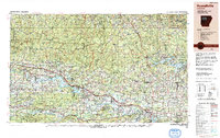
1992 Map of Russellville
USGS Topo · Published 1993About this map
The Arkansas River corridor serves as the central artery for this region of the Ozark foothills, where the massive impoundment of Lake Dardanelle meets the industrial and transport hubs of Russellville and Dardanelle. This landscape transitions from the high peaks of the Boston Mountains in the north to the Ouachita Mountains in the south, anchored by geological landmarks such as Magazine Mtn and Petit Jean Mtn. The 1990s infrastructure is well-defined, showing the path of the Union Pacific Railroad and Missouri Pacific Railroad alongside the corridor of I-40. Recreational and conservation areas are prominent, with the expansive Ozark National Forest and Ouachita National Forest covering much of the terrain, while the eastern edge is defined by the recreation-heavy shoreline of Greers Ferry Lake near Heber Springs.
Find a feature on this map
48 named features on this map. Tap any name to fly to it.
Don’t see what you’re looking for? This feature index may not catch every label — zoom into the map to look around manually.
Map Details
Editions of this 1992 Russellville Map
This is the sole edition of this map. No revisions or reprints were ever made.
Other maps of this area

1879 · Poteau Mountain
USGS Topo · 1:62,500

1879 · Cravens
USGS Topo · 1:62,500

1879 · Mountain Home
USGS Topo · 1:62,500

1879 · Washington
USGS Topo · 1:62,500

1887 · Poteau Mountain #1
USGS Topo · 1:62,500

1887 · Magazine Mountain #1
USGS Topo · 1:62,500

1887 · Smyrna
USGS Topo · 1:62,500

1887 · Magazine Mountain #4
USGS Topo · 1:62,500

1887 · Mount Ida #2
USGS Topo · 1:62,500

1887 · Magazine Mountain #2
USGS Topo · 1:62,500