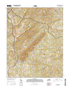
2016 Map of Rustburg
USGS Topo · Published 2016About this map
The village of Rustburg serves as the central hub for this portion of Campbell County, characterized by a complex network of creeks and prominent ridges. The geography is defined by the significant elevations of Long Mtn and Jack Mtn, which separate the various watersheds feeding into the S Fork Falling River. Local history and family genealogy are well-represented by a high density of small family burial grounds, including Falwell Cem, Burford Cem, and Tweedy Cem, indicating long-standing settlement patterns in the rural spaces between Concord and Bocock. Transport and commerce are anchored by the presence of Breezy Knoll Airport and several localized water bodies such as Silver Spring Lake and Lynch Lake, reflecting the contemporary land use of this Piedmont landscape.
Find a feature on this map
128 named features on this map. Tap any name to fly to it.
Don’t see what you’re looking for? This feature index may not catch every label — zoom into the map to look around manually.
Map Details
Editions of this 2016 Rustburg Map
This is the sole edition of this map. No revisions or reprints were ever made.
Other maps of this area

1892 · Lynchburg
USGS Topo · 1:125,000

1892 · Appomattox
USGS Topo · 1:125,000

1944 · Lynchburg
USGS Topo · 1:62,500

1947 · Roanoke
USGS Topo · 1:250,000

1950 · Lynchburg
USGS Topo · 1:62,500

1956 · Brookneal
USGS Topo · 1:62,500

1956 · Gladys
USGS Topo · 1:62,500

1958 · Appomattox
USGS Topo · 1:62,500

1959 · Roanoke
USGS Topo · 1:250,000

1963 · Roanoke
USGS Topo · 1:250,000