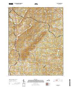
2019 Map of Rustburg
USGS Topo · Published 2019About this map
Rustburg serves as the focal point of this survey, featuring the prominent Campbell County Courthouse at its center. The settlement patterns extend northward toward Lynchburg and include the established areas of Bocock, East Brook, and Thomas Terrace. This map reveals a landscape defined by significant elevation changes, from the prominent ridge of Long Mtn to the sharp descent of Wheeler Cliff overlooking the S Fork Falling River.
Find a feature on this map
142 named features on this map. Tap any name to fly to it.
Don’t see what you’re looking for? This feature index may not catch every label — zoom into the map to look around manually.
Map Details
Editions of this 2019 Rustburg Map
This is the sole edition of this map. No revisions or reprints were ever made.
Other maps of this area

1892 · Lynchburg
USGS Topo · 1:125,000

1892 · Appomattox
USGS Topo · 1:125,000

1944 · Lynchburg
USGS Topo · 1:62,500

1947 · Roanoke
USGS Topo · 1:250,000

1950 · Lynchburg
USGS Topo · 1:62,500

1956 · Brookneal
USGS Topo · 1:62,500

1956 · Gladys
USGS Topo · 1:62,500

1958 · Appomattox
USGS Topo · 1:62,500

1959 · Roanoke
USGS Topo · 1:250,000

1963 · Roanoke
USGS Topo · 1:250,000