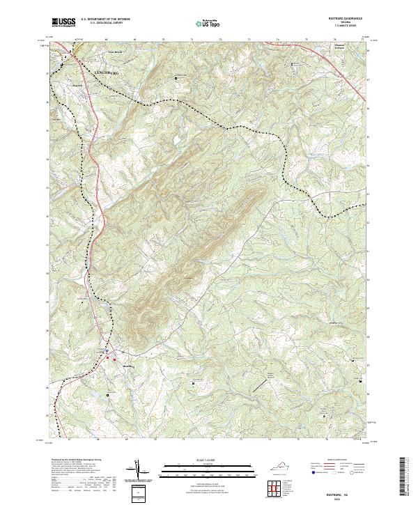
2022 Map of Rustburg
USGS Topo · Published 2022About this map
Rustburg serves as a focal point for the surrounding Campbell County landscape, defined by a network of creeks and prominent ridges. The Campbell County Courthouse stands as a central landmark in the village, which sits at the junction of several county roads including Co Rd 615 and Co Rd 663. The terrain is characterized by significant natural features like Jack Mtn in the west and Long Mtn near the center, while Wheeler Cliff overlooks the S Fork Falling River to the east.
Find a feature on this map
63 named features on this map. Tap any name to fly to it.
Don’t see what you’re looking for? This feature index may not catch every label — zoom into the map to look around manually.
Map Details
Editions of this 2022 Rustburg Map
This is the sole edition of this map. No revisions or reprints were ever made.
Other maps of this area

1892 · Lynchburg
USGS Topo · 1:125,000

1892 · Appomattox
USGS Topo · 1:125,000

1944 · Lynchburg
USGS Topo · 1:62,500

1947 · Roanoke
USGS Topo · 1:250,000

1950 · Lynchburg
USGS Topo · 1:62,500

1956 · Brookneal
USGS Topo · 1:62,500

1956 · Gladys
USGS Topo · 1:62,500

1958 · Appomattox
USGS Topo · 1:62,500

1959 · Roanoke
USGS Topo · 1:250,000

1963 · Roanoke
USGS Topo · 1:250,000