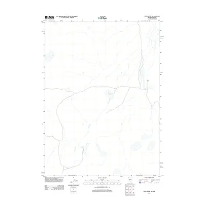
2011 Map of Rye Creek
USGS Topo · Published 2011About this map
IXL Ranch and the Last Chance Rnch anchor this sparsely settled stretch of the high desert near the Nevada-Oregon border. The landscape is defined by its seasonal water management, essential for ranching in this arid environment. Key infrastructure includes the Rye Creek Reservoir and the Racetrack Reservoir, which capture runoff from intermittent drainage systems. Rye Creek and Catnip Creek wind through the terrain, illustrating the critical role of these narrow riparian corridors for livestock and local habitation in northern Washoe County. The network of local roads and 4WD tracks connecting these remote outposts underscores the isolation and utilitarian nature of the region during this period.
Find a feature on this map
6 named features on this map. Tap any name to fly to it.
Don’t see what you’re looking for? This feature index may not catch every label — zoom into the map to look around manually.
Map Details
Editions of this 2011 Rye Creek Map
This is the sole edition of this map. No revisions or reprints were ever made.
Other maps of this area

1889 · Long Valley
USGS Topo · 1:250,000

1954 · Vya
USGS Topo · 1:250,000

1955 · Adel
USGS Topo · 1:250,000

1957 · Adel
USGS Topo · 1:250,000

1958 · Vya
USGS Topo · 1:250,000

1958 · Adel
USGS Topo · 1:250,000

1962 · Vya
USGS Topo · 1:250,000

1962 · Adel
USGS Topo · 1:250,000

1966 · Catnip Canyon
USGS Topo · 1:24,000

1966 · Bald Mountain
USGS Topo · 1:24,000