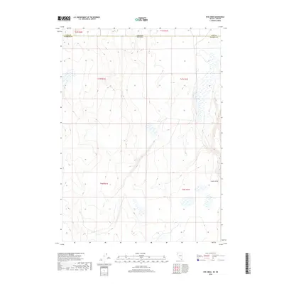
2018 Map of Rye Creek
USGS Topo · Published 2018About this map
Guano Valley dominates the southeastern quadrant of this high-desert landscape along the border of Nevada and Oregon. This 2018 survey reveals a terrain defined by subtle seasonal drainages and vast open basins, where the ephemeral Rye Cr and Catnip Cr snake through the northern Great Basin's alkaline flats and volcanic plateaus. The map details the complex jurisdictional boundaries where Washoe County, Nevada, meets Lake County, Oregon, a region historically used for open-range grazing. While modern cartography tracks these remote townships and ranges, the primary features remain the natural landforms that have dictated human movement and land use since early homesteading efforts in the desert west.
Find a feature on this map
11 named features on this map. Tap any name to fly to it.
Don’t see what you’re looking for? This feature index may not catch every label — zoom into the map to look around manually.
Map Details
Editions of this 2018 Rye Creek Map
This is the sole edition of this map. No revisions or reprints were ever made.
Other maps of this area

1889 · Long Valley
USGS Topo · 1:250,000

1954 · Vya
USGS Topo · 1:250,000

1955 · Adel
USGS Topo · 1:250,000

1957 · Adel
USGS Topo · 1:250,000

1958 · Vya
USGS Topo · 1:250,000

1958 · Adel
USGS Topo · 1:250,000

1962 · Vya
USGS Topo · 1:250,000

1962 · Adel
USGS Topo · 1:250,000

1966 · Catnip Canyon
USGS Topo · 1:24,000

1966 · Bald Mountain
USGS Topo · 1:24,000