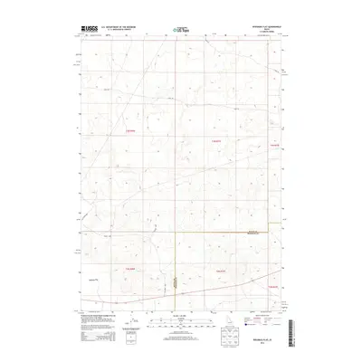
2013 Map of Ryegrass Flat
USGS Topo · Published 2013About this map
Ryegrass Flat defines this Idaho landscape along the administrative boundary of Butte and Bingham Counties. This high-desert terrain is structured by a grid of named routes that suggest a history of transit across the arid flats. Functional thoroughfares such as 7 Mile Rd and Stage Rd cut across the topography, the latter's name hinting at early transportation corridors through the Snake River Plain. The southern portion of the map is marked by a concentration of named boulevards, including Wilson Blvd, Jefferson Blvd, and Fillmore Blvd, which overlay the surveyed sections of t2n r30e and t2n r31e. This cartographic record from the U.S. Geological Survey documents the intersection of public land survey divisions and local road networks in a sparsely populated region of the state.
Find a feature on this map
13 named features on this map. Tap any name to fly to it.
Don’t see what you’re looking for? This feature index may not catch every label — zoom into the map to look around manually.
Map Details
Editions of this 2013 Ryegrass Flat Map
This is the sole edition of this map. No revisions or reprints were ever made.
Other maps of this area

1955 · Idaho Falls
USGS Topo · 1:250,000

1958 · Idaho Falls
USGS Topo · 1:250,000

1973 · Little Butte NW
USGS Topo · 1:24,000

1973 · Scoville
USGS Topo · 1:24,000

1973 · Middle Butte
USGS Topo · 1:24,000

1973 · Circular Butte 3 NE
USGS Topo · 1:24,000

1973 · Atomic City
USGS Topo · 1:24,000

1973 · Circular Butte 3 SW
USGS Topo · 1:24,000

1973 · Circular Butte 3 SE
USGS Topo · 1:24,000

1973 · Little Butte SW
USGS Topo · 1:24,000