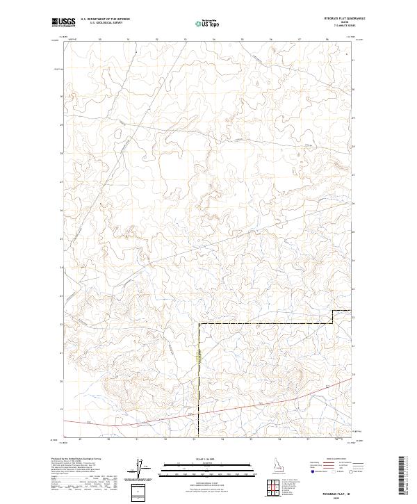
2023 Map of Ryegrass Flat
USGS Topo · Published 2023About this map
High desert terrain along the Butte and Bingham County line characterizes this 2023 survey of the Ryegrass Flat region. The landscape is defined by its remote transportation network, where legacy routes like Stage Rd and Seven Mile Rd traverse the open flats of the Snake River Plain. This area is heavily segmented by the Public Land Survey System, as evidenced by the prominent grid lines of Township 3 North, Range 31 East and its neighbors. To the south, a series of named thoroughfares including Jefferson Blvd, Wilson Blvd, and Fillmore Blvd suggests structured land management or potential development corridors within the expansive sagebrush steppe of eastern Idaho. The map captures the intersection of traditional western range travel and modern cadastral organization in a sparsely populated but geographically distinct part of the state.
Find a feature on this map
15 named features on this map. Tap any name to fly to it.
Don’t see what you’re looking for? This feature index may not catch every label — zoom into the map to look around manually.
Map Details
Editions of this 2023 Ryegrass Flat Map
This is the sole edition of this map. No revisions or reprints were ever made.
Other maps of this area

1955 · Idaho Falls
USGS Topo · 1:250,000

1958 · Idaho Falls
USGS Topo · 1:250,000

1973 · Little Butte NW
USGS Topo · 1:24,000

1973 · Scoville
USGS Topo · 1:24,000

1973 · Middle Butte
USGS Topo · 1:24,000

1973 · Circular Butte 3 NE
USGS Topo · 1:24,000

1973 · Atomic City
USGS Topo · 1:24,000

1973 · Circular Butte 3 SW
USGS Topo · 1:24,000

1973 · Circular Butte 3 SE
USGS Topo · 1:24,000

1973 · Little Butte SW
USGS Topo · 1:24,000