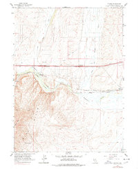
1962 Map of Ryndon
USGS Topo · Published 1978About this map
Humboldt River carving through the narrow passage of Osino Canyon dominates this 1960s landscape, illustrating the critical transportation corridor of northeastern Nevada. The parallel alignments of the Southern Pacific and Western Pacific railroads follow the river's path, marking the region's historic role as a transcontinental gateway. Small settlements like Ryndon and Elburz serve as focal points along the rail lines, while the rugged terrain of Elko Mtn rises to the southwest. Evidence of local land use is seen in the Borrow Pits and Gravel Pit near the highway, supporting the development of the Ryndon Interchange. Remote landmarks like Sustacha Spring and a lonely Grave near the tracks hint at the solitary nature of ranching and transit in the High Desert during this era.
Find a feature on this map
22 named features on this map. Tap any name to fly to it.
Don’t see what you’re looking for? This feature index may not catch every label — zoom into the map to look around manually.
Map Details
Editions of this 1962 Ryndon Map
3 editions found
Other maps of this area

1935 · Halleck
USGS Topo · 1:125,000

1955 · Wells
USGS Topo · 1:250,000

1955 · Elko
USGS Topo · 1:250,000

1957 · Elko East
USGS Topo · 1:24,000

1958 · Wells
USGS Topo · 1:250,000

1958 · Elko
USGS Topo · 1:250,000

1961 · Wells
USGS Topo · 1:250,000

1962 · Elko
USGS Topo · 1:250,000

1962 · Boyd Reservoir
USGS Topo · 1:24,000

1962 · Ryndon
USGS Topo · 1:24,000