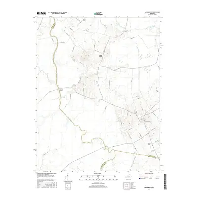
2016 Map of Sacramento
USGS Topo · Published 2016About this map
The Pond River snakes along the western border of this Kentucky landscape, defining the winding boundary between Hopkins and McLean counties. The town of Sacramento anchors the southeastern corner, serving as a hub for local routes like Whitmer Rd and Stringer Rd. This 2016 survey illustrates a rural terrain where agriculture and aviation meet at Woosley Airport and Shannon Field, while prominent relief is found at Rattle Snake Hill. Historians and genealogists can pinpoint several local landmarks including the Moore Cem near Poplar Grove and the Free Union Cem further south. The map also records essential river crossings such as Brazzel Bridge and Coffman Bridge, alongside numerous tributaries like Cypress Creek and Pond Drain that carve through the bottomlands.
Find a feature on this map
64 named features on this map. Tap any name to fly to it.
Don’t see what you’re looking for? This feature index may not catch every label — zoom into the map to look around manually.
Map Details
Editions of this 2016 Sacramento Map
This is the sole edition of this map. No revisions or reprints were ever made.
Other maps of this area

1906 · Sutherland
USGS Topo · 1:62,500

1908 · Calhoun
USGS Topo · 1:62,500

1909 · Madisonville
USGS Topo · 1:62,500

1909 · Central City
USGS Topo · 1:62,500

1952 · Livermore
USGS Topo · 1:24,000

1952 · Sacramento
USGS Topo · 1:24,000

1952 · Calhoun
USGS Topo · 1:24,000

1952 · Beech Grove
USGS Topo · 1:24,000

1952 · Hanson
USGS Topo · 1:24,000

1953 · Madisonville East
USGS Topo · 1:24,000