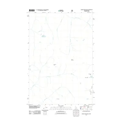
2011 Map of Saddle Mountain
USGS Topo · Published 2011About this map
Saddle Mountain and the high ridges of the Bitterroot Range define this landscape along the Idaho-Montana border as it appeared in 2011. The topography is dominated by a complex network of drainages, including the headwaters of East Fork Moose Creek, Saddle Creek, and Wahoo Creek. High-altitude water bodies such as Battle Lake and Upper Twin Lake are positioned near prominent summits like Cove Peak and Big Creek Point. The map illustrates the specialized mountain transit routes used for forest access, notably the Twin Lakes Rd 5605, which reaches toward the high passes. Strategic gaps in the ridgeline, such as Lost Horse Pass and Wahoo Pass, indicate the traditional paths through this steep terrain, serving as vital connections for surveys and backcountry travel in Ravalli County.
Find a feature on this map
17 named features on this map. Tap any name to fly to it.
Don’t see what you’re looking for? This feature index may not catch every label — zoom into the map to look around manually.
Map Details
Editions of this 2011 Saddle Mountain Map
This is the sole edition of this map. No revisions or reprints were ever made.
Other maps of this area

1901 · Hamilton
USGS Topo · 1:125,000

1911 · Lolo
USGS Topo · 1:250,000

1913 · Lolo
USGS Topo · 1:250,000

1956 · Hamilton
USGS Topo · 1:250,000

1959 · Hamilton
USGS Topo · 1:250,000

1960 · Hamilton
USGS Topo · 1:250,000

1964 · Hamilton
USGS Topo · 1:250,000

1964 · Tenmile Lake
USGS Topo · 1:24,000
1964 · El Capitan
USGS Topo · 1:24,000

1966 · Twin Butte
USGS Topo · 1:24,000