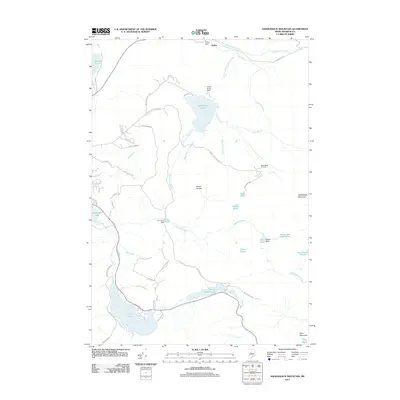
2011 Map of Saddleback Mountain
USGS Topo · Published 2011About this map
Saddleback Mountain and the surrounding highlands of Franklin County define this landscape of interconnected water bodies and mountain recreation. The 2011 survey details the complex hydrography of the region, from the South Branch Dead River and Saddleback Lake in the north to the Sandy River Ponds and Long Pond at the southern boundary. Man-made interventions in this wilderness are evident through the Flagg Dam, Dead River Dam, and City Pond Dam, which regulate the flow of the South Branch Dead River and its tributaries. The map also documents the infrastructure of the Saddleback Ski Area and a dense network of local roads such as Dallas Hill Rd and Saddleback Ski Area Rd. Geological and recreational landmarks like Oakes Nubble, Piazza Rock, and Ledge Pond provide specific points of interest for navigating this high-altitude terrain in the early 21st century.
Find a feature on this map
60 named features on this map. Tap any name to fly to it.
Don’t see what you’re looking for? This feature index may not catch every label — zoom into the map to look around manually.
Map Details
Editions of this 2011 Saddleback Mountain Map
This is the sole edition of this map. No revisions or reprints were ever made.
Other maps of this area

1928 · Stratton
USGS Topo · 1:48,000

1929 · Phillips
USGS Topo · 1:48,000

1932 · Phillips
USGS Topo · 1:62,500

1932 · Stratton
USGS Topo · 1:62,500

1932 · Kennebago Lake
USGS Topo · 1:48,000

1933 · Rangeley
USGS Topo · 1:48,000

1935 · Kennebago Lake
USGS Topo · 1:62,500

1936 · Kennebago Lake
USGS Topo · 1:62,500

1939 · Rangeley
USGS Topo · 1:62,500

1949 · Jackman
USGS Topo · 1:250,000
Featured Places
- Dallas Plantation, ME
- Rangeley Plantation, ME
- Madrid Township, ME
- Sandy River Plantation, ME
- Redington Township, ME