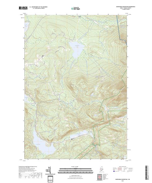
2024 Map of Saddleback Mountain
USGS Topo · Published 2024About this map
The high peaks of western Maine dominate this landscape, centered on the prominent massif of Saddleback Mtn and the surrounding wilderness of Redington Township. The Appalachian-National Scenic Trail traverses the ridgeline, passing a network of high-elevation water bodies including Eddy Pond, Ethel Pond, and Saddleback Pond. This modern survey illustrates the complex drainage patterns of the region, where the South Branch Dead River and Sandy River originate among steep slopes and glacial features like Oakes Nubble.
Find a feature on this map
66 named features on this map. Tap any name to fly to it.
Don’t see what you’re looking for? This feature index may not catch every label — zoom into the map to look around manually.
Map Details
Editions of this 2024 Saddleback Mountain Map
This is the sole edition of this map. No revisions or reprints were ever made.
Other maps of this area

1928 · Stratton
USGS Topo · 1:48,000

1929 · Phillips
USGS Topo · 1:48,000

1932 · Phillips
USGS Topo · 1:62,500

1932 · Stratton
USGS Topo · 1:62,500

1932 · Kennebago Lake
USGS Topo · 1:48,000

1933 · Rangeley
USGS Topo · 1:48,000

1935 · Kennebago Lake
USGS Topo · 1:62,500

1936 · Kennebago Lake
USGS Topo · 1:62,500

1939 · Rangeley
USGS Topo · 1:62,500

1949 · Jackman
USGS Topo · 1:250,000
Featured Places
- Dallas Plantation, ME
- Rangeley Plantation, ME
- Madrid Township, ME
- Sandy River Plantation, ME
- Redington Township, ME