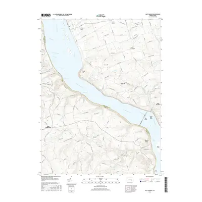
2016 Map of Safe Harbor
USGS Topo · Published 2016About this map
The Susquehanna River serves as the central artery and natural boundary between Lancaster and York Counties in this mid-2010s survey. The map details the complex topography of the river gorge, highlighting the dramatic transition from the plateau down to the water at Turkey Hill and the series of islands including Else Island and Indian Rock Island. The eastern bank is dotted with historic rural settlements such as Washington Boro, Creswell, and the eponymous village of Safe Harbor, situated where the Conestoga River joins the larger flow.
Find a feature on this map
139 named features on this map. Tap any name to fly to it.
Don’t see what you’re looking for? This feature index may not catch every label — zoom into the map to look around manually.
Map Details
Editions of this 2016 Safe Harbor Map
This is the sole edition of this map. No revisions or reprints were ever made.
Other maps of this area

1902 · Lancaster
USGS Topo · 1:62,500

1904 · Lancaster
USGS Topo · 1:62,500

1908 · Middletown
USGS Topo · 1:62,500

1908 · York
USGS Topo · 1:62,500

1910 · York
USGS Topo · 1:62,500

1912 · Mc Calls Ferry
USGS Topo · 1:62,500

1943 · Lancaster
USGS Topo · 1:62,500

1943 · Middletown
USGS Topo · 1:62,500

1943 · Mc Calls Ferry
USGS Topo · 1:62,500

1948 · Baltimore
USGS Topo · 1:250,000
Featured Places
- Conestoga Township, PA
- Lower Chanceford Township, PA
- Lower Windsor Township, PA
- Bridgeville, Chanceford Township
- Letort, Manor Township