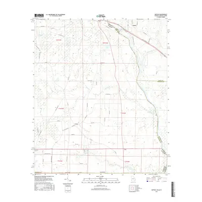
2017 Map of Saffold
USGS Topo · Published 2017About this map
The Chattahoochee River carves a winding path along the tri-state boundary of Alabama, Georgia, and Florida, serving as a primary geographic anchor for this 2017 survey. Small communities like Crosby, Lucy, and Alaga dot the rural landscape, connected by a network of named local roads such as Willoughby Rd and Barksdale Rd. The river floodplain is defined by intricate drainage systems including Kirkland Cr and Bryans Creek, which transition into low-lying wetlands like The Turnpike Swamp in the northwest. Local history is preserved in sites like Friendship Cem and the evocatively named Confederate Naval Yard Rd near Saffold. The map captures a landscape shaped by both the natural movement of the river and the legacy of early southern settlement, with family-named routes like Oscar Helms Rd and Paul Jeffcoat Rd illustrating the long-standing community ties to the Houston County countryside.
Find a feature on this map
62 named features on this map. Tap any name to fly to it.
Don’t see what you’re looking for? This feature index may not catch every label — zoom into the map to look around manually.
Map Details
Editions of this 2017 Saffold Map
This is the sole edition of this map. No revisions or reprints were ever made.
Other maps of this area

1952 · Malone
USGS Topo · 1:24,000

1952 · Bascom
USGS Topo · 1:24,000

1953 · Dothan
USGS Topo · 1:250,000

1954 · Dothan
USGS Topo · 1:250,000

1954 · Steam Mill
USGS Topo · 1:24,000

1954 · Tallahassee
USGS Topo · 1:250,000

1955 · Dothan
USGS Topo · 1:250,000

1959 · Tallahassee
USGS Topo · 1:250,000

1960 · Tallahassee
USGS Topo · 1:250,000

1970 · Gordon
USGS Topo · 1:24,000