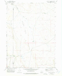
1971 Map of Sage Hen Flats
USGS Topo · Published 1975About this map
Petroglyphs near The Potholes mark the northwest corner of this 1970s survey, indicating a long human presence in this high desert landscape. The terrain is defined by the broad expanse of Sage Hen Flats, a high-elevation basin punctuated by critical water sources like Dixon Waterhole and Sage Hen Spring. The drainage of Sage Hen Creek meanders across the flats toward the Sage Hen Hills to the south.
Find a feature on this map
14 named features on this map. Tap any name to fly to it.
Don’t see what you’re looking for? This feature index may not catch every label — zoom into the map to look around manually.
Map Details
Editions of this 1971 Sage Hen Flats Map
This is the sole edition of this map. No revisions or reprints were ever made.
Other maps of this area

1889 · Long Valley
USGS Topo · 1:250,000

1954 · Vya
USGS Topo · 1:250,000

1955 · Adel
USGS Topo · 1:250,000

1957 · Adel
USGS Topo · 1:250,000

1958 · Vya
USGS Topo · 1:250,000

1958 · Adel
USGS Topo · 1:250,000

1962 · Vya
USGS Topo · 1:250,000

1962 · Adel
USGS Topo · 1:250,000

1966 · Catnip Canyon
USGS Topo · 1:24,000

1966 · Big Spring Butte
USGS Topo · 1:62,500