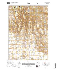
2020 Map of Sage Hen Hill
USGS Topo · Published 2020About this map
The northern reaches of Ochoco National Forest define this high-desert landscape in Harney County, where water management is the primary marker of human activity. Dozens of small-scale impoundments and catchments, including Military Reservoir, Bentonite Reservoir, and Box Spring Reservoir, dot the terrain to support livestock and wildlife in an otherwise arid environment. The map details a complex system of seasonal drainages such as Virginia Cr and Sage Hen Cr, which flow between prominent volcanic and tectonic features like Sundown Ridge and Blackie Butte. Significant local routes, including Sage Hen Hill Rd and Pine Spring Basin Rd, provide access to the interior, crossing through names that suggest the area's geological and ranching history, from Rock Quarry Canyon to the Bridge Waterhole.
Find a feature on this map
34 named features on this map. Tap any name to fly to it.
Don’t see what you’re looking for? This feature index may not catch every label — zoom into the map to look around manually.
Map Details
Editions of this 2020 Sage Hen Hill Map
This is the sole edition of this map. No revisions or reprints were ever made.
Other maps of this area

1955 · Burns
USGS Topo · 1:250,000

1958 · Burns
USGS Topo · 1:250,000

1959 · Burns
USGS Topo · 1:250,000

1959 · Dog Mountain
USGS Topo · 1:62,500

1960 · Burns
USGS Topo · 1:62,500

1979 · Moon Reservoir
USGS Topo · 1:24,000

1980 · Palomino Buttes
USGS Topo · 1:24,000

1981 · Sage Hen Hill
USGS Topo · 1:24,000
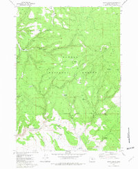
1981 · Egypt Canyon
USGS Topo · 1:24,000
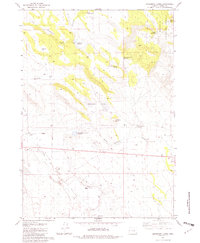
1981 · Oakerman Lakes
USGS Topo · 1:24,000